Map of National Parks in South America Jau National Park Xingu National Park & Indigenous Area Manu National Park Nahuel Huapi National Park Tierra del Fuego National Park Torres del Paine National Park Image Map

Park Patterns and the Past:

Have you ever wondered how National Parks happen? Who decides to when to protect wild nature? Where? Why? This website explores some of the most majestic natural areas in South America to provide varied perspectives that give possible answers to these questions and many more.

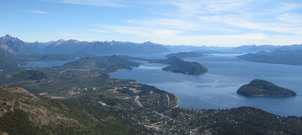
One important pattern that emerges is that natural field science and conservation grew up together in the two paradigmatic ecological and cultural regions of Patagonia and Amazonia. These environments have direct bearing on the world’s climate system, the regulation of carbon in the atmosphere, and the preservation of species ranging from ferns to felids. Importantly, they are also home to tens of thousands of native peoples (including the Mapuche, Yaghan, Xingu, and Matshigenka), and hundreds of thousands of mixed-race and European settlers. Together, science and conservation have indelibly shaped South America, a continent that today reserves more than a fifth of its territory in some form of protected natural area.

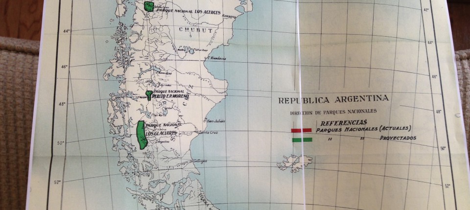
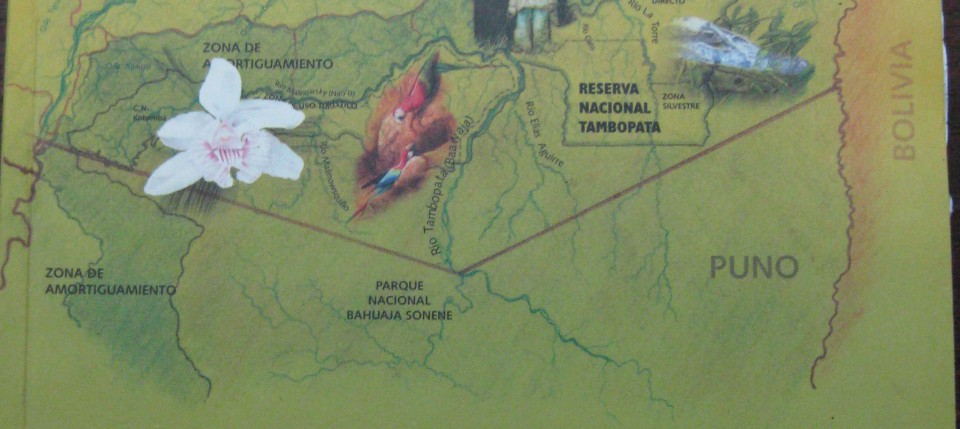
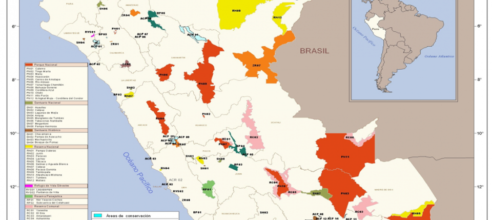
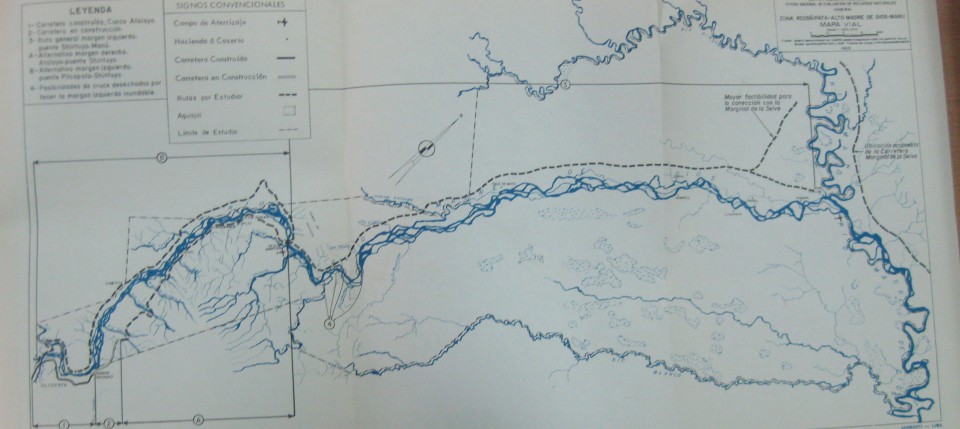
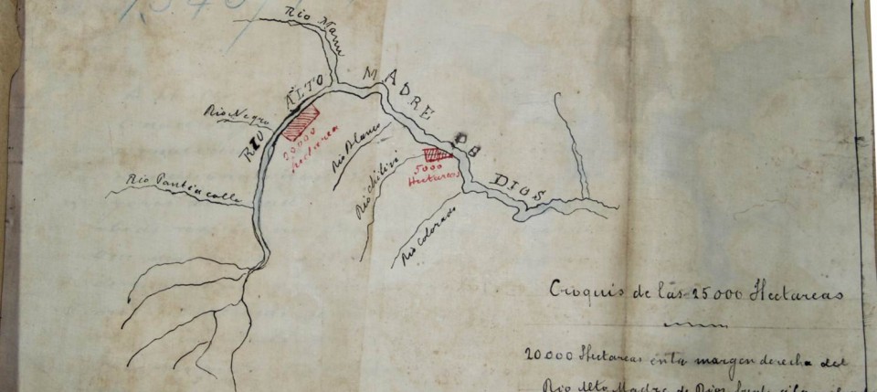
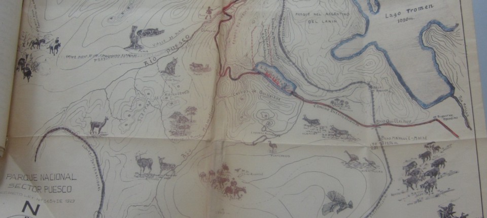
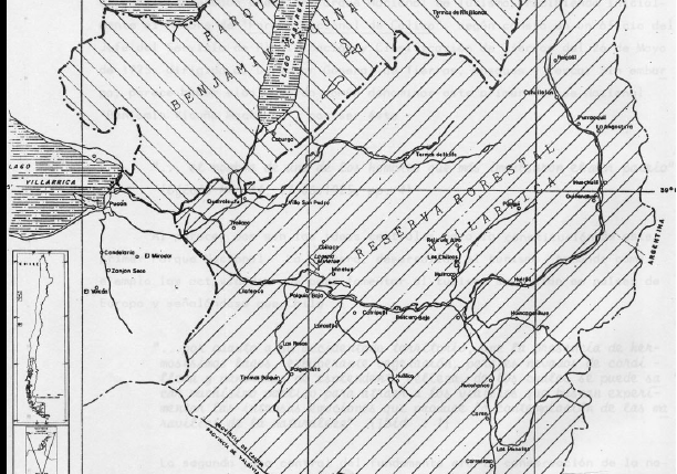
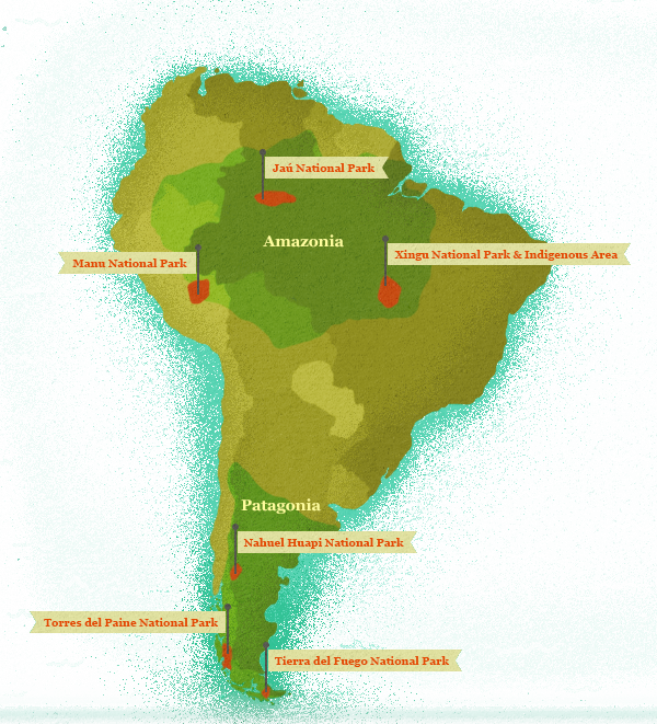
Another pattern involves the expansion of parks from single protected areas into constellations of large, connected, contiguous areas. Each of the parks explored here (and we only feature six of the hundreds of possible parks) resides in a neighborhood filled with similar sites. Sometimes these are national parks from another country, other times they are reserves for native peoples, or areas with different conservation protections. To talk about Peru’s Manu National Park then is to also imply that Alto Purus National Park, the Amarakaeri Communal Reserve, and the Los Amigos Conservation Concession share a connected history with the original park. These constellations and their growth and dynamism matters to understanding how parks are created and what they mean to different kinds of people. Parks, their names, their designations, and their dilemmas change over time and this contingency forms an important—but slippery—part of their story.

This website invites you to choose your own explanations based on historical data. Explore the comparative biographical statistics on the parks—their dates of creation, sizes, neighbors, and remarkable features. Then listen to scientists and conservationists provide testimony in their own words about their interest in national parks and why these places matter. Travel through the timeline looking at different primary sources that provide glimpses of the parks from earlier times. When you are finished, leave us a line letting us know what you learned.

Conservation Timeline

TimelineNahuelHuapi

Nahuel Huapi National Park, Argentina

Nahuel Huapi was South America’s first national park.  It was first designated a national park by the scientist, Francisco “Perito” Moreno in 1903. 

1903
monilaVillarrica

Villarrica Forest Reserve, Chile

This reserve was the first of five protected areas in the general area near Villarrica volcano.  The region was depicted by the Chilean born Jesuit priest and early naturalist, Juan Ignacio Molina, in his 1788 map.

1912
MapVillarricaBenjaminVicunaMackenna1929

Benjamin Vicuña Mackenna National Park, Chile

Chile’s first national park was created on December 22, 1925 but it did not last long.  The area was carved away for settlement just four years later.  It no longer exists as a national park.

1925

Vicente Pérez Rosales National Park, Chile

In 1926, this park was created as adjacent and the west and south of Argentina’s Nahuel Huapi National Park. It was expanded five years later and appealed greatly to the skiers and recreationists of the Alpine Club of Osorno.

1926
MapNPS

Lanín National Park, Argentina

To the north of Nahuel Huapi, Lanín National Park was named after the perfectly symmetrical conical mountain said to compare with Japan’s Mt. Fuji.

1937

Oral History

Primary Documents

ParkResidents1986

Article about Manu Park Residents, 1986.

Scientists, including anthropologists, wrote prolifically about the park in the 1980s.  Nearly all of them gave some attention to the residents of the park, both ancient and contemporary.  In this article summarizing the park’s attributes, Peruvian researcher Gustavo Ruiz Pereyra describes and visually depicts these attributes including the largest native group in the park, the […]

CashuMap2004

Maps of Trails at Cocha Cashu in 1980, 1984, and 2004

The first idea for a national park came from an initial biological station set up to study caimans in the lowland lakes of this area.  By the early 1970s, scientists saw the benefits that would come from a permanent station for researchers and with funds from the Peruvian government, the Frankfurt Zoological Society, and the […]

CarreteraMarginalSelvaMadresdeDios

Competing Plans for Use of Manu Lands, 1960s

In these two maps, the first of the planned ‘jungle highway’ in 1965 and the second of the proposed National Park area in 1968, depicted very different ideas for the use of the rivers in this region.  What are those contrasting uses? What possibilities does each map raise? Do they share any similarities?  Why do […]

ManuFantasyVillage

Newspaper Article about Manu’s Isolation, 1959

The collapse of the price of rubber on the world market led to a rapid decolonization of the region.  Adding to the social and economic factors, the dynamism of the rivers in the Manu area made settlements precarious.  For instance, when rivers flooded their banks they might also inundate settlements placed there for easy access […]

RubberBoomMadre

Concessions for Rubber Extraction, 1909

The land that became Manu National Park was never pristine or uninhabited but the scale of use had been minimal until the ‘rubber boom’ from 1890-1920 where concessions of land were granted to prospectors looking to extract rubber from the trees using native laborers and sell it on the world market for a premium.  Prospectors […]

VillaricaGudenschwagerMap1959

Gudenschwager Map of Villarrica, 1959.

This map was included with a request to the park administrator by the local resident, Otto Gudenschwager to strengthen protection within Villarrica National Park.  Note the detailed sketches of regional flora and fauna.  Also note historic events depicted such as Spanish conquistadores and cattle drives.  Why does it seem the author is advocating the park?  […]

MAPVillarricaBenjaminVicunaMackenna1929

Chilean Park Boundaries, 1920s

In this map, the author tries to depict the changes that took place to Benamin Vicuna McKenna National Park and Villarrica Forest Reserve and National Park in the 1920s, 1930s, and beyond.  Note the location of Lakes Villarrica, Colico, and Caburca as well as rivers, roads, and settlements. Compare the landscape features depicted on this […]

NahuelHuapiPamphlet1937museopatagonia 079

Nahuel Huapi Pamphlet, 1937

This pamphlet produced by the Argentine government made it’s way into the United States National Park Service files.  What scenic or recreational aspects does this advertisement invoke?  How is the National Park Division presenting the park and to whom are they focusing?  How is the pamphlet different from the brochure?  Is the audience different?

NahuelHuapiBrochure1934museopatagonia 076

Nahuel Huapi Brochure, 1934

This brochure was produced by the Argentine government and circulated in other countries, including in the United States.  What scenic or recreational aspects does this advertisement invoke?  How is the National Park Division presenting the park and to whom are they focusing?

TheDiary1904Glimpse

Newspaper report on Moreno’s donation, 1904

Why would a newspaper report on the donation of private land for a national park?  How does this Buenos Aires newspaper describe Moreno’s donation?  Does it capture the same sentiments in the letter?

MorenosLetter1903

Moreno’s Letter Donating the Park, 1903

This is the six page handwritten letter sent by Moreno to the Argentine government explaining his proposed donation of land for the purpose of creating a national park.  What are the reasons Moreno gives for donating the land?  What does this tell us about him as a scientist? As a citizen?  What sorts of symbols, […]

WillisNahuelHuapi1914

Willis Map of Nahuel Huapi, 1914

Bailey Willis, an employee of the United States Geological Service, was hired by Ezequiel Ramos Mexia of the Argentine government to complete a survey of a proposed railroad line.  This line would connect Nahuel Huapi with the Atlantic Coast and the nearly 600 page report from the survey included this map of the area around […]

MorenoMapTripNahuelHuapi1897

Moreno’s Trip to Nahuel Huapi, 1896

Moreno’s 1896 trip included a team of seventeen scientists and assistants who covered nearly ten degrees latitude and 7,000 kilometers in five months. Can you locate Nahuel Huapi on the map? How does it compare to other features on the map? On Page 58, he notes, “Thinking about this program of progress, already in the […]