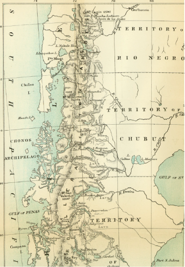
Moreno’s 1896 trip included a team of seventeen scientists and assistants who covered nearly ten degrees latitude and 7,000 kilometers in five months. Can you locate Nahuel Huapi on the map? How does it compare to other features on the map? On Page 58, he notes, “Thinking about this program of progress, already in the process of realization, I crossed here beautiful natural parks that circle the lake on the south, devastated in the upper part by a voracious fire that destroyed millions of pesos in construction lumber, and I arrived at the arroyo that drops water from Lake Guitierrez into Lake Nahuel Huapi.” What does this tell us about his understanding of the landscape? What does the map tell us about the region described within?