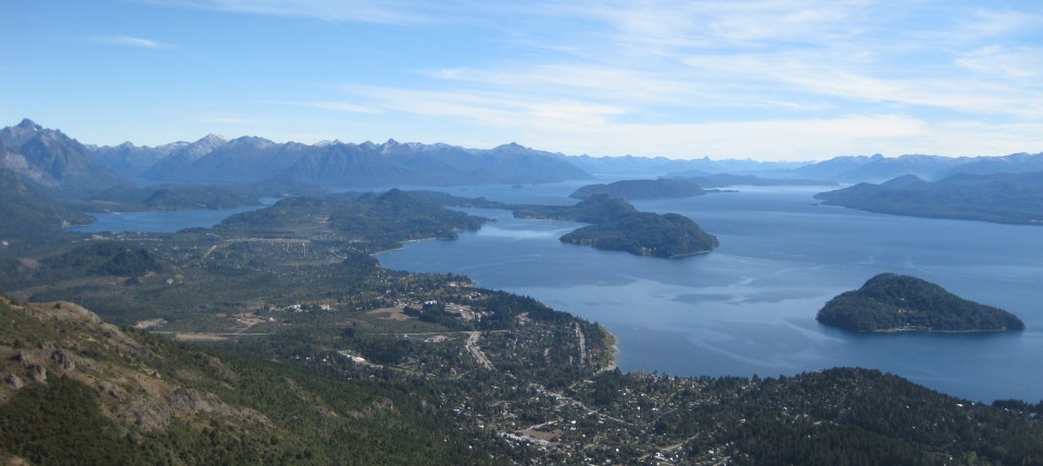
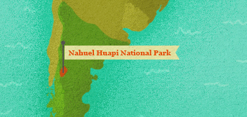
Nahuel Huapi National Park, Argentina
Nahuel Huapi was South America’s first national park. It was first designated a national park by the scientist, Francisco “Perito” Moreno in 1903.
1903
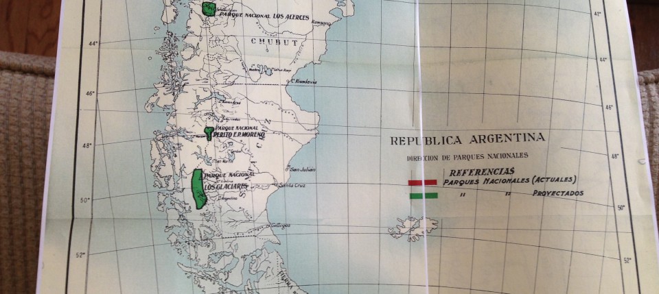
Nahuel Huapi National Park, situated on the Argentine lake of the same name, was the first national park in South America. It was created in 1903 when Francisco P. Moreno donated three leagues of his own property to the government with the understanding that it would form the nucleus of a national park, call the National Park of the South. This land was adjacent to the growing village of San Carlos de Bariloche and the region received ample attention from the national government in the next few decades. Scientists charted a railroad path to link the settlement and new park to the coast and the capital city of Buenos Aires. Settlers arrived with plans to develop ranches, orchards, and even ski resorts. In 1922 the Argentine government added territory to Moreno’s donation and in 1934 the government created the Park Service (Dirección General de Parques Nacionales) which changed the name to Nahuel Huapi.
As the oldest park in Patagonia, Nahuel Huapi formed a template of sorts for other parks. For instance, Chile’s second and now oldest park, Vicente Pérez Rosales, was created adjacent to Nahuel Huapi in 1926. Many similarities exist between the Chilean and Argentine parks of this region, making the park constellation—or the larger complex of park entities—as significant as the original park. Nahuel Huapi served as a model for other Argentine parks and for the region. When the International Union for the Conservation of Nature decided to hold its first conference in Latin America in 1968, San Carlos de Bariloche and Nahuel Huapi National Park were the chosen setting.
What did it mean at the time of declaration that Patagonia got a National Park? What role did a scientist like Francisco Moreno play in the creation of the park and scientific arguments for it? How did Argentines advertise the park? How was its legacy recognized? The documents below provide some testimony to help answer these questions.
Many different documents exist to tell the story of this park but Patagonian documents have a significant memorializing flair. The first two documents highlight two trip reports, that of Moreno’s second trip to the region in 1896 and a map of the 1912 trip of Bailey Willis, in charge of the railroad planning. The second two documents provide glimpses into the personal life of the famous park personality, Moreno through the letter he wrote donating the park and newspaper coverage of that event. The next pair of documents, the pamphlet and brochure from the park, can be credited to the new National Park Division. Then, three maps read as documents help to situate the park’s geography by including parks on the Chilean side of the international boundary. Finally, a speech presented by known Mexican conservationist, Enrique Beltrán pays homage to Moreno and the park during the 1968 conference in the park.
Nahuel Huapi was South America’s first national park. It was first designated a national park by the scientist, Francisco “Perito” Moreno in 1903.
Chile’s first federally created nature protection area was a forest reserve.
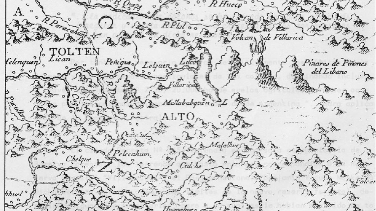
This reserve was the first of five protected areas in the general area near Villarrica volcano. The region was depicted by the Chilean born Jesuit priest and early naturalist, Juan Ignacio Molina, in his 1788 map.
Chile’s first national park was created on December 22, 1925 but it did not last long. The area was carved away for settlement just four years later. It no longer exists as a national park.
In 1926, this park was created as adjacent and the west and south of Argentina’s Nahuel Huapi National Park. It was expanded five years later and appealed greatly to the skiers and recreationists of the Alpine Club of Osorno.
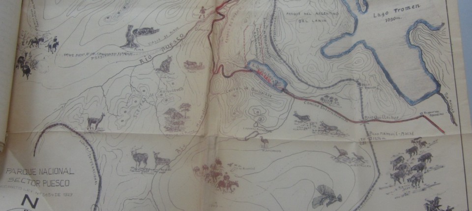
To the north of Nahuel Huapi, Lanín National Park was named after the perfectly symmetrical conical mountain said to compare with Japan’s Mt. Fuji.
This map was included with a request to the park administrator by the local resident, Otto Gudenschwager to strengthen protection within Villarrica National Park. Note the detailed sketches of regional flora and fauna. Also note historic events depicted such as Spanish conquistadores and cattle drives. Why does it seem the author is advocating the park? […]
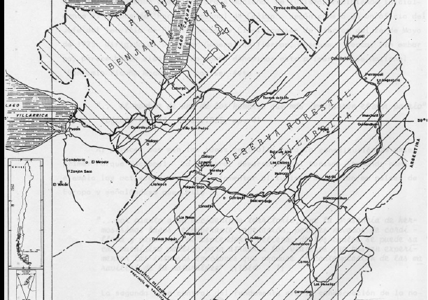
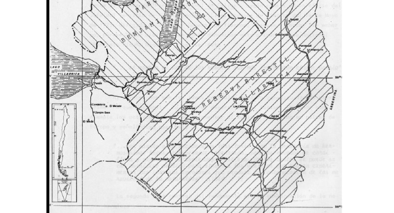
In this map, the author tries to depict the changes that took place to Benamin Vicuna McKenna National Park and Villarrica Forest Reserve and National Park in the 1920s, 1930s, and beyond. Note the location of Lakes Villarrica, Colico, and Caburca as well as rivers, roads, and settlements. Compare the landscape features depicted on this […]
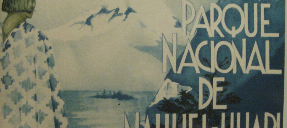
This pamphlet produced by the Argentine government made it’s way into the United States National Park Service files. What scenic or recreational aspects does this advertisement invoke? How is the National Park Division presenting the park and to whom are they focusing? How is the pamphlet different from the brochure? Is the audience different?
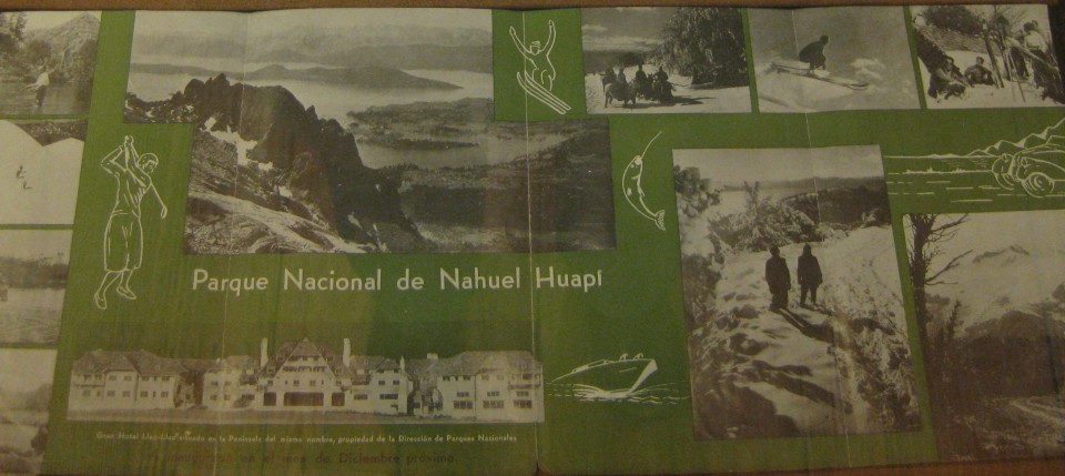
This brochure was produced by the Argentine government and circulated in other countries, including in the United States. What scenic or recreational aspects does this advertisement invoke? How is the National Park Division presenting the park and to whom are they focusing?
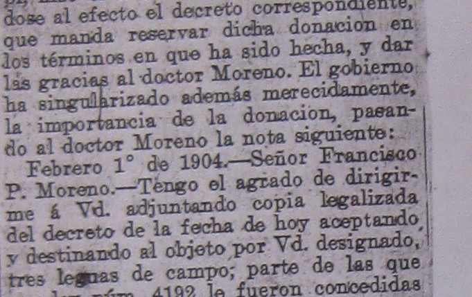
Why would a newspaper report on the donation of private land for a national park? How does this Buenos Aires newspaper describe Moreno’s donation? Does it capture the same sentiments in the letter?
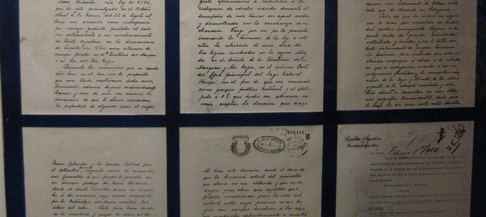
This is the six page handwritten letter sent by Moreno to the Argentine government explaining his proposed donation of land for the purpose of creating a national park. What are the reasons Moreno gives for donating the land? What does this tell us about him as a scientist? As a citizen? What sorts of symbols, […]
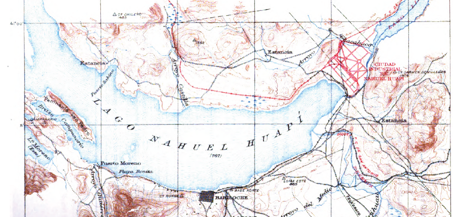
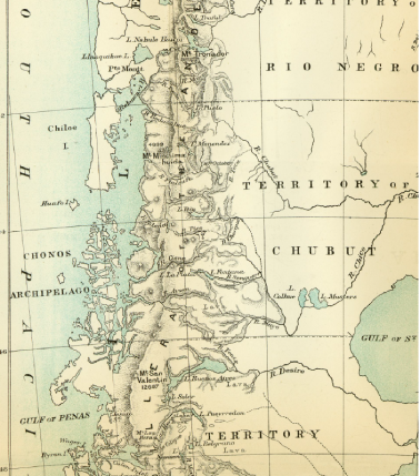
Bailey Willis, an employee of the United States Geological Service, was hired by Ezequiel Ramos Mexia of the Argentine government to complete a survey of a proposed railroad line. This line would connect Nahuel Huapi with the Atlantic Coast and the nearly 600 page report from the survey included this map of the area around […]
Moreno’s 1896 trip included a team of seventeen scientists and assistants who covered nearly ten degrees latitude and 7,000 kilometers in five months. Can you locate Nahuel Huapi on the map? How does it compare to other features on the map? On Page 58, he notes, “Thinking about this program of progress, already in the […]