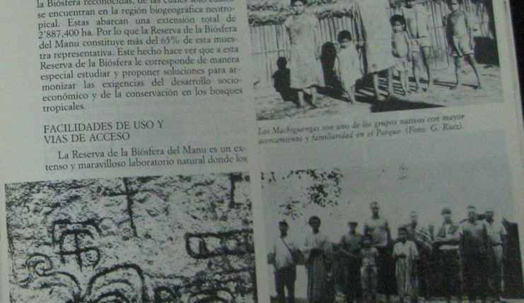
Scientists, including anthropologists, wrote prolifically about the park in the 1980s. Nearly all of them gave some attention to the residents of the park, both ancient and contemporary. In this article summarizing the park’s attributes, Peruvian researcher Gustavo Ruiz Pereyra describes and visually depicts these attributes including the largest native group in the park, the […]
The first idea for a national park came from an initial biological station set up to study caimans in the lowland lakes of this area. By the early 1970s, scientists saw the benefits that would come from a permanent station for researchers and with funds from the Peruvian government, the Frankfurt Zoological Society, and the […]
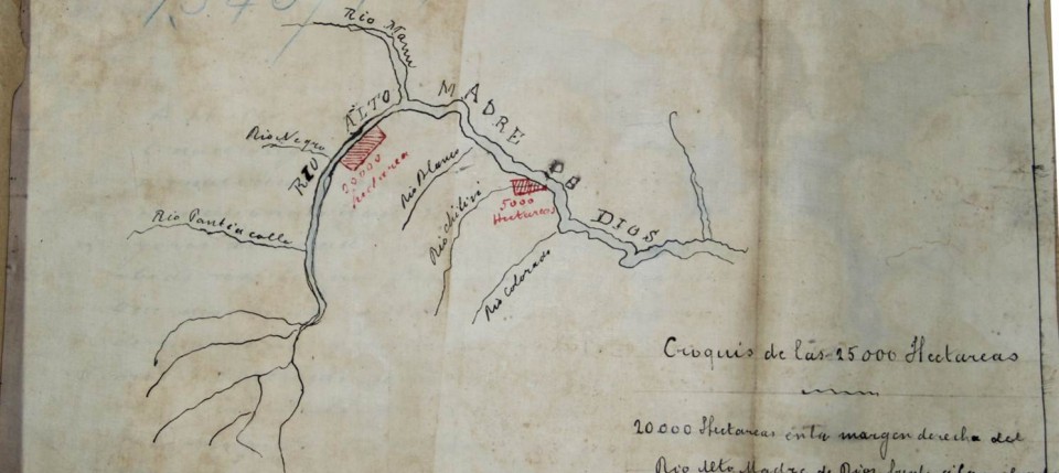
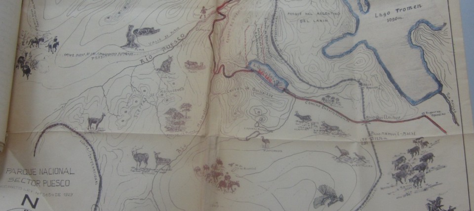
In these two maps, the first of the planned ‘jungle highway’ in 1965 and the second of the proposed National Park area in 1968, depicted very different ideas for the use of the rivers in this region. What are those contrasting uses? What possibilities does each map raise? Do they share any similarities? Why do […]
The collapse of the price of rubber on the world market led to a rapid decolonization of the region. Adding to the social and economic factors, the dynamism of the rivers in the Manu area made settlements precarious. For instance, when rivers flooded their banks they might also inundate settlements placed there for easy access […]
The land that became Manu National Park was never pristine or uninhabited but the scale of use had been minimal until the ‘rubber boom’ from 1890-1920 where concessions of land were granted to prospectors looking to extract rubber from the trees using native laborers and sell it on the world market for a premium. Prospectors […]
This map was included with a request to the park administrator by the local resident, Otto Gudenschwager to strengthen protection within Villarrica National Park. Note the detailed sketches of regional flora and fauna. Also note historic events depicted such as Spanish conquistadores and cattle drives. Why does it seem the author is advocating the park? […]
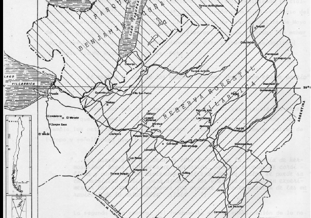
In this map, the author tries to depict the changes that took place to Benamin Vicuna McKenna National Park and Villarrica Forest Reserve and National Park in the 1920s, 1930s, and beyond. Note the location of Lakes Villarrica, Colico, and Caburca as well as rivers, roads, and settlements. Compare the landscape features depicted on this […]
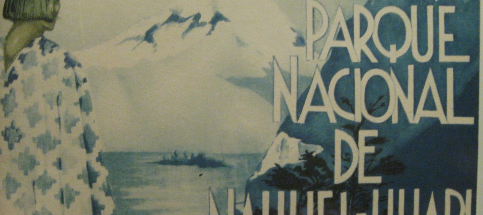
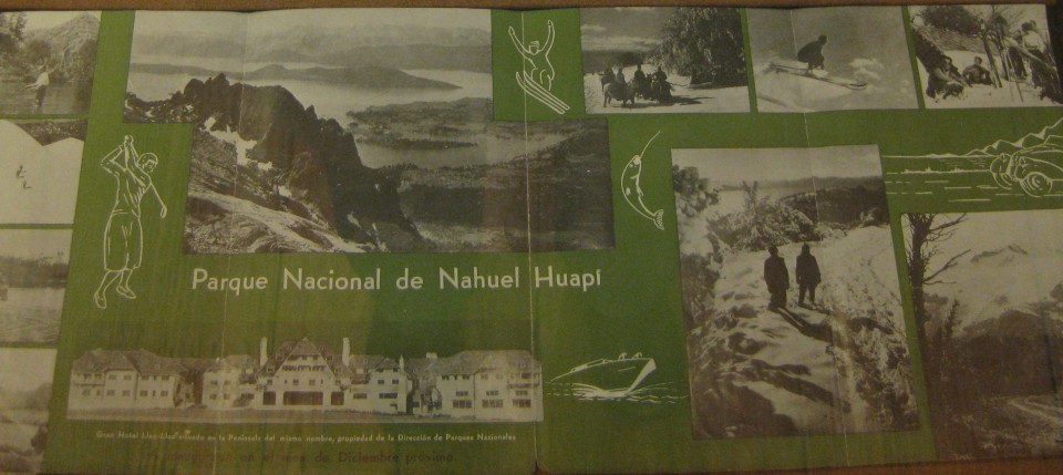
This pamphlet produced by the Argentine government made it’s way into the United States National Park Service files. What scenic or recreational aspects does this advertisement invoke? How is the National Park Division presenting the park and to whom are they focusing? How is the pamphlet different from the brochure? Is the audience different?
This brochure was produced by the Argentine government and circulated in other countries, including in the United States. What scenic or recreational aspects does this advertisement invoke? How is the National Park Division presenting the park and to whom are they focusing?
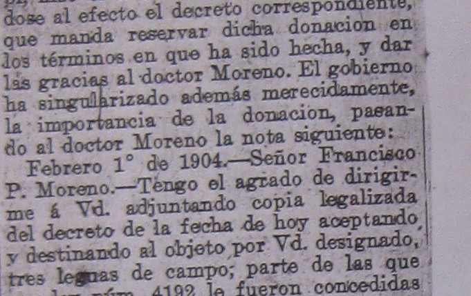
Why would a newspaper report on the donation of private land for a national park? How does this Buenos Aires newspaper describe Moreno’s donation? Does it capture the same sentiments in the letter?
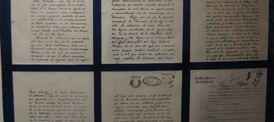
This is the six page handwritten letter sent by Moreno to the Argentine government explaining his proposed donation of land for the purpose of creating a national park. What are the reasons Moreno gives for donating the land? What does this tell us about him as a scientist? As a citizen? What sorts of symbols, […]
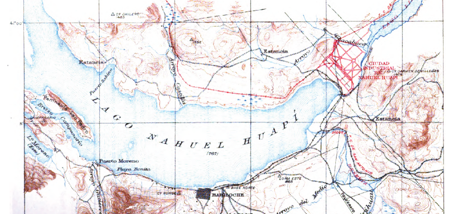
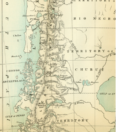
Bailey Willis, an employee of the United States Geological Service, was hired by Ezequiel Ramos Mexia of the Argentine government to complete a survey of a proposed railroad line. This line would connect Nahuel Huapi with the Atlantic Coast and the nearly 600 page report from the survey included this map of the area around […]
Moreno’s 1896 trip included a team of seventeen scientists and assistants who covered nearly ten degrees latitude and 7,000 kilometers in five months. Can you locate Nahuel Huapi on the map? How does it compare to other features on the map? On Page 58, he notes, “Thinking about this program of progress, already in the […]