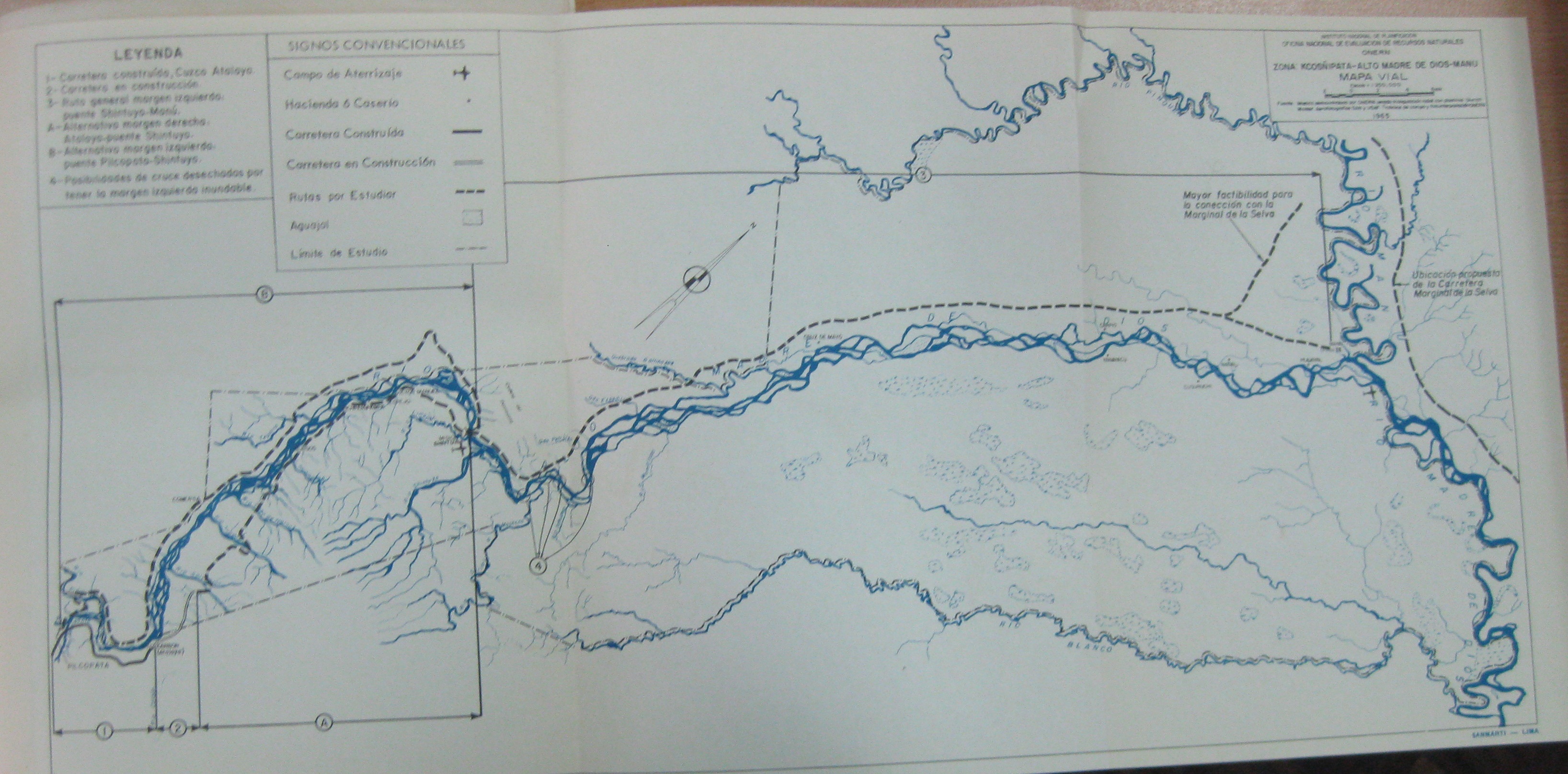
In these two maps, the first of the planned ‘jungle highway’ in 1965 and the second of the proposed National Park area in 1968, depicted very different ideas for the use of the rivers in this region. What are those contrasting uses? What possibilities does each map raise? Do they share any similarities? Why do you suppose the park was created but the highway never was?