Pacaya-Samira National Reserve, Peru
1972
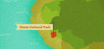
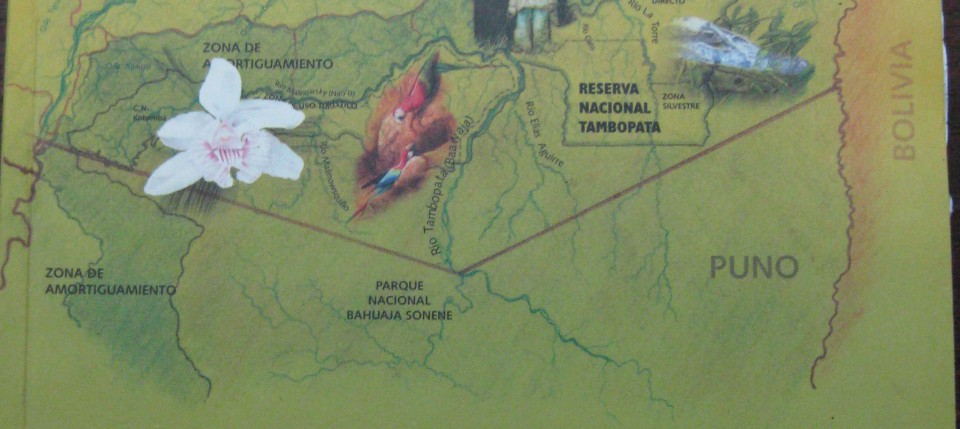
Located in the far western Amazon basin and the Peruvian departments of Madre de Dios and Cusco, the park was officially created by the Peruvian government in 1973. It is widely recognized in international ecological circles for the field-changing science emerged from the location and for the remarkably intact ecosystems ranging up the Andean slope and down into the tropical lowlands. The region is characterized by rivers which serve as the only transportation channels for most of the park.
Long before its creation as a National Park the region was lauded with superlatives. The superlatives come in three general varieties—geographic, scientific, or cultural. The geographical statistics point out the size, siting, or the remoteness of the site. These include descriptions of the lack of services including roads and supplies. Scientific statistics come next and these provide an overview of the numbers of species, the comparative percentages of the world’s stock these include, and the relationship to biodiversity. The remaining superlatives and statistics describe the cultural contradictions embodied in the park, describe or illustrate the living communities of indigenous people, especially the Matsigenka, within the park.
The park’s area has never been empty of human habitation or modern designs but it remains one of the foremost examples of wild nature in the world because of the density and scale of self-willed land in and around the park. From rubber to gold to oil, various schemes have been developed to bleed the jungle of its riches with adverse effects on the residents or native peoples. But the park has thus far remained resilient and demonstrates an excellent example of the scale necessary to allow nature to rebound and recover from overuse.
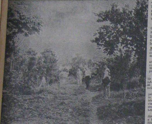
Consider how these documents testify to the use and nonuse of nature within the park. First, look at the map of land concessions to consider how rubber prospectors envisioned making their mark on the region. Then consider the fate of the region in the images and newspaper article forty years later. What changed? Now turn to the development map planning a road through the region. You may wonder how this supports or refutes earlier development schemes. Reconsider the park timeline as you reflect on the next set of three maps of the research station at Cocha Cashu. Consider how the trails at the station change over time and the difference in scale from the first two maps. Finally, examine the description and pictures of residents in the park provided by the Peruvian researcher in the 1980s.

Antonio Brack Egg
Antonio Brack Egg
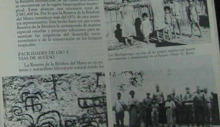
Scientists, including anthropologists, wrote prolifically about the park in the 1980s. Nearly all of them gave some attention to the residents of the park, both ancient and contemporary. In this article summarizing the park’s attributes, Peruvian researcher Gustavo Ruiz Pereyra describes and visually depicts these attributes including the largest native group in the park, the […]
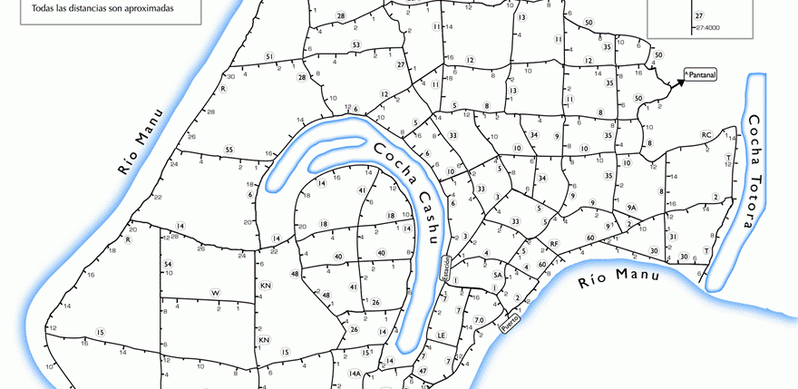
The first idea for a national park came from an initial biological station set up to study caimans in the lowland lakes of this area. By the early 1970s, scientists saw the benefits that would come from a permanent station for researchers and with funds from the Peruvian government, the Frankfurt Zoological Society, and the […]
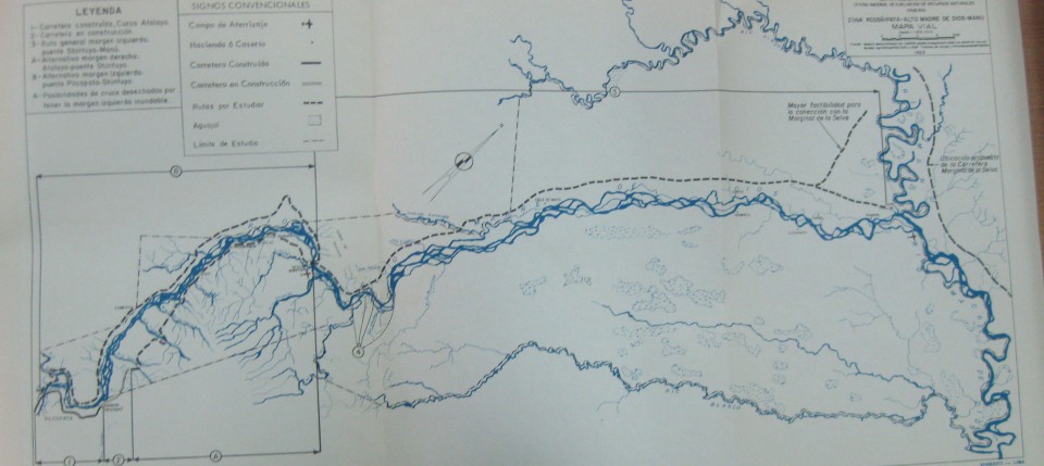
In these two maps, the first of the planned ‘jungle highway’ in 1965 and the second of the proposed National Park area in 1968, depicted very different ideas for the use of the rivers in this region. What are those contrasting uses? What possibilities does each map raise? Do they share any similarities? Why do […]
The collapse of the price of rubber on the world market led to a rapid decolonization of the region. Adding to the social and economic factors, the dynamism of the rivers in the Manu area made settlements precarious. For instance, when rivers flooded their banks they might also inundate settlements placed there for easy access […]
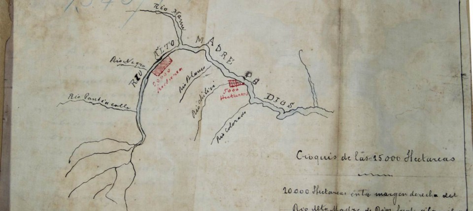
The land that became Manu National Park was never pristine or uninhabited but the scale of use had been minimal until the ‘rubber boom’ from 1890-1920 where concessions of land were granted to prospectors looking to extract rubber from the trees using native laborers and sell it on the world market for a premium. Prospectors […]