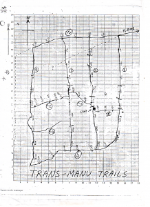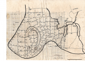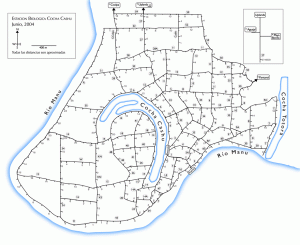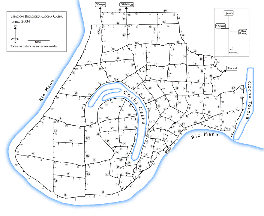
The first idea for a national park came from an initial biological station set up to study caimans in the lowland lakes of this area. By the early 1970s, scientists saw the benefits that would come from a permanent station for researchers and with funds from the Peruvian government, the Frankfurt Zoological Society, and the World Wildlife Fund, the biological station at Cocha Cashu lake was built. Over time, researchers built trails to be able to follow the abundant wildlife efficiently. That way, a researcher could watch a troop of monkeys all day, return to camp at night, and direct a team member back to the exact spot where the monkeys slept that night. What other uses might you expect from this trail system? What are the major features depicted on the maps? How are the trails numbered and organized? How do these maps demonstrate how the trails changed over time? Do they demonstrate changes to scientific research?