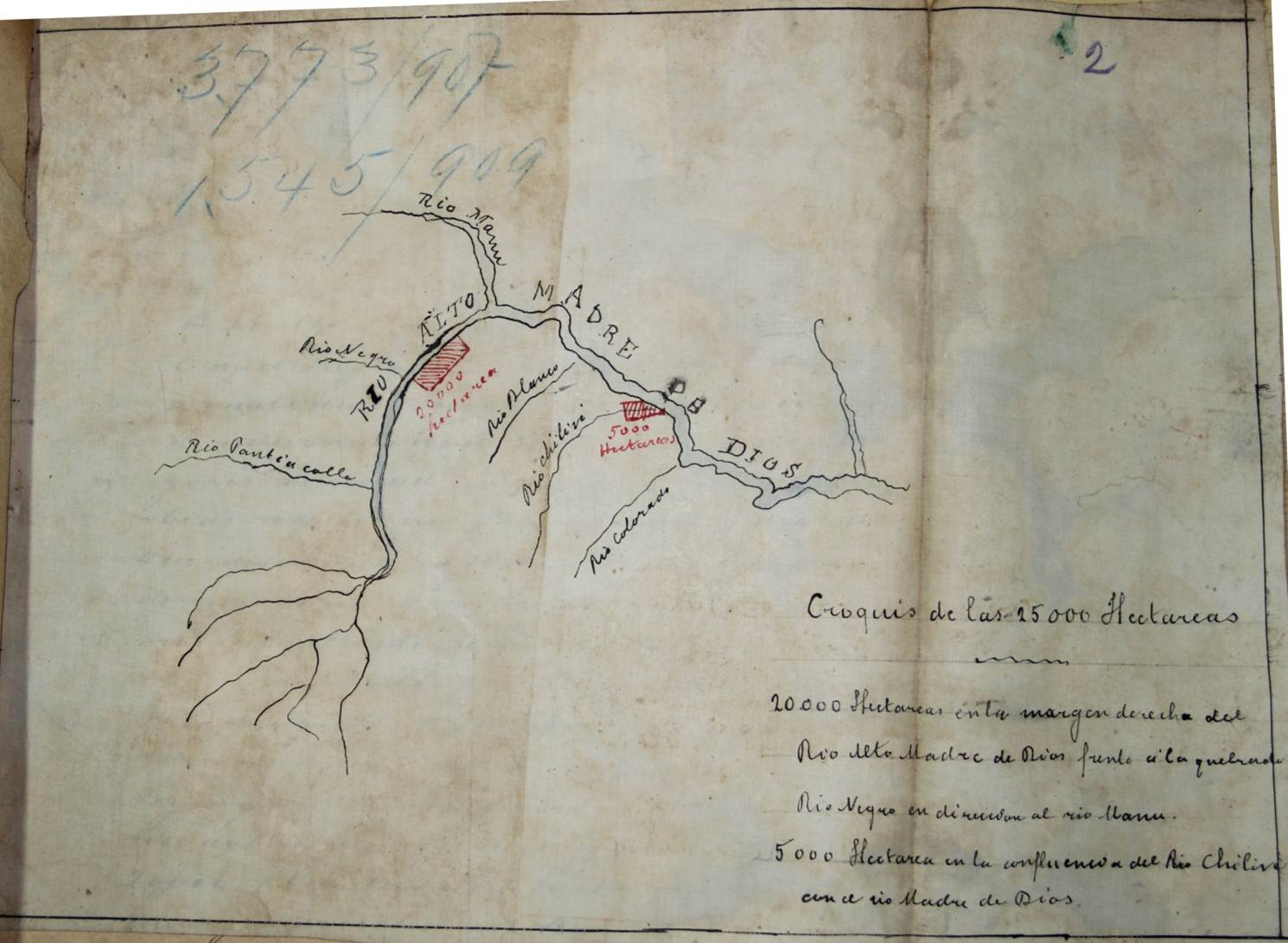
The land that became Manu National Park was never pristine or uninhabited but the scale of use had been minimal until the ‘rubber boom’ from 1890-1920 where concessions of land were granted to prospectors looking to extract rubber from the trees using native laborers and sell it on the world market for a premium. Prospectors could request concessions of land, such as those depicted on this map, and often they promised some sort of infrastructure development (a road, a telegraph) in exchange for virtually free land. Note the names of the rivers as they will appear in later park maps. Where did prospectors position their requests and why do you think they chose those locations to request? What do the many tributaries and their size tell you about the river’s flow? What can we make of the blank spaces on the map?