Bailey Willis, an employee of the United States Geological Service, was hired by Ezequiel Ramos Mexia of the Argentine government to complete a survey of a proposed railroad line. This line would connect Nahuel Huapi with the Atlantic Coast and the nearly 600 page report from the survey included this map of the area around Moreno’s park donation and the settlement of San Carlos de Bariloche. How does Willis sketch the lake in this map? What features does he propose and what are notable geographic or geologic attributes? Who are they named after and why? What other signs of development or settlement are depicted in the map?
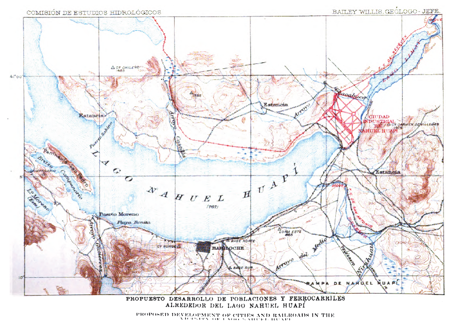
Bailey Willis, map of Nahuel Huapi Lake, Northern Patagonia Character and Resources, 1914. Map on page 409.