This map was included with a request to the park administrator by the local resident, Otto Gudenschwager to strengthen protection within Villarrica National Park. Note the detailed sketches of regional flora and fauna. Also note historic events depicted such as Spanish conquistadores and cattle drives. Why does it seem the author is advocating the park? What might be the reason to include the drawings of animals and of the area’s history?
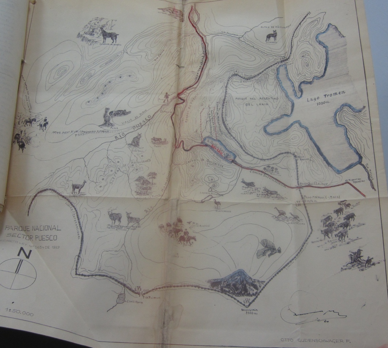
Otto Gudenschwager Map, 1959. Archivo Nacional, Chile, Ministerio Agricultura, 1949, Decreto Supremo 1353.