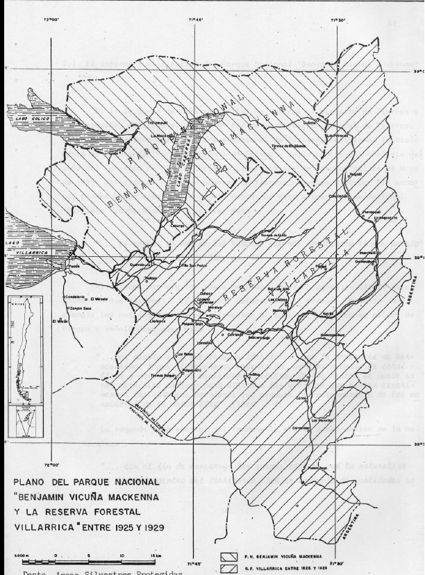
In this map, the author tries to depict the changes that took place to Benamin Vicuna McKenna National Park and Villarrica Forest Reserve and National Park in the 1920s, 1930s, and beyond. Note the location of Lakes Villarrica, Colico, and Caburca as well as rivers, roads, and settlements. Compare the landscape features depicted on this map with the protection declarations. Can you tell the difference between a forest reserve and a park based solely on this map? Compare this map with the next one of the same area, just a larger segment. How do the designations shift over time?
Maps Benjamin Vicuña Mackenna National Park and Villarrica Forest Reserve, 1925 and Map of Villarrica and Huerquehue National Parks. In Ángel Cabeza Monteira, Aspectos históricos de la legislación forestal vinculada a la conservación, la evolución de las áreas silvestres protegidas de la zona de Villarrica y la creación del primer parque nacional de Chile, (Santiago: CONAF, 1988).